
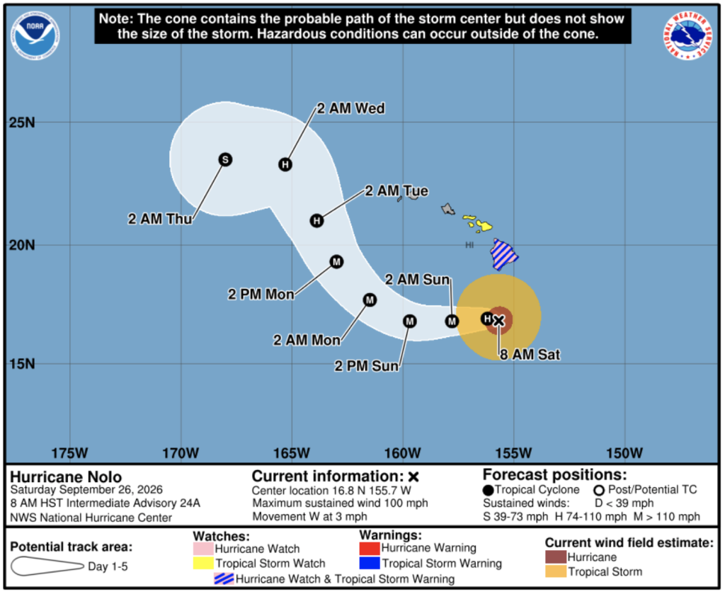
The storm has stayed nearly stationary as of Saturday morning, still bringing heavy rain, gusty winds and large waves to portions of the Hawaiian Islands. Forecasters expect Nolo to strengthen into a major Category 3 hurricane tonight or early Sunday, with peak intensity forecast for early Monday.
A westward motion with increasing forward speed is expected later Saturday and into Sunday, followed by a turn toward the northwest, per the Central Pacific Hurricane Center's outlook.
For people across the Hawaiian Islands, the slow crawl means an extended stretch of rough surf, wind and rain rather than a quick pass. Storms that linger can do more damage than ones that move through fast, and Nolo's stall south of Hawaii Island gives forecasters time to watch it strengthen before it finally picks up speed. That combination, a stationary storm expected to reach Category 3, raises the stakes heading into the weekend.