
Tuesday highs should run about 10 degrees above average, with southwesterly winds of 10 to 20 mph and occasional stronger gusts. This evening brings a slight chance of isolated showers or storms, mainly west of I-27 and Highway 87 on the Caprock. Most of the area stays dry, and overnight lows dip into the cool 60s.
Then a strong storm system moves in Tuesday night, and thunderstorms are likely, some of them severe. Damaging large hail, wind gusts and heavy rain top the list of threats. The Storm Prediction Center has issued a Slight Risk for severe weather across the area. The tornado threat is very low, but forecasters can't rule out an isolated tornado or two.
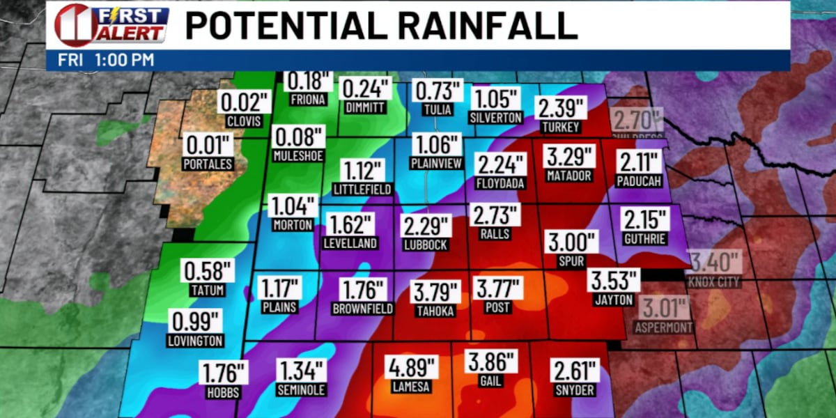
Rain may be the bigger problem. Heavy rainfall could stretch from Wednesday through Thursday, especially in the southeastern part of the area. Totals of 2 to 3 inches are possible, and some spots could pick up more than 4. Fast rain like that can cause localized flooding, particularly where drainage is poor or the ground already took on water recently.
If you have plans late Tuesday, check the sky first.
Summer-level moisture is arriving in the middle of October.