
Local News
Morning showers, thunderstorms to start off Thursday, expected to continue - KCBD
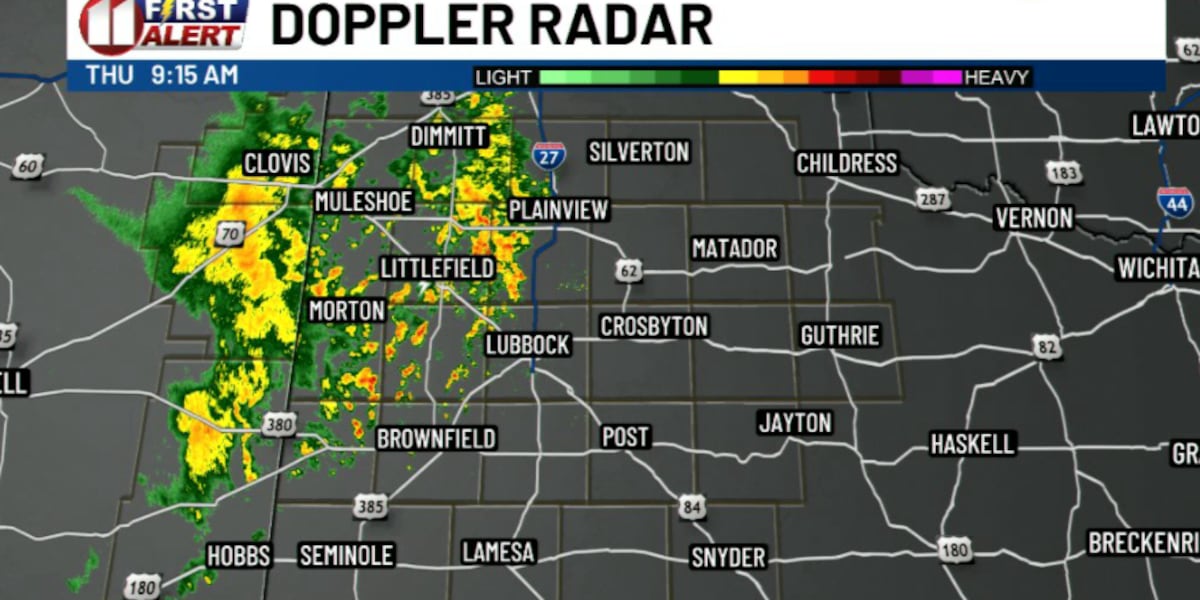
A line of showers and storms crossed the Texas-New Mexico state line into the Caprock region Thursday morning, bringing locally heavy rainfall and gusty winds to Lubbock and surrounding areas.
The system moved northeastward overnight and approached areas near Interstate 27, with occasionally gusty winds and brief downpours expected to stick around western portions of the Caprock through mid-morning. Folks in Lubbock heading out for the morning commute should expect wet roads and reduced visibility in spots, especially anyone crossing I-27 or driving through the western edge of town.
The rain doesn't wrap up with the morning drive. Additional scattered showers and storms are expected to fire up again Thursday afternoon and continue into the evening, with the Caprock staying the favored target area. Isolated storms could bring their own bursts of heavy rain on top of what already fell earlier in the day.
For anyone with outdoor plans this week, from Tech Terrace lawn work to evening walks near the Depot District, this is a stretch to keep an eye on the sky rather than the forecast from a few days ago. Heavy rainfall in a short window can mean standing water on low spots around town, and gusty winds could complicate anything not tied down. The system is expected to linger through the end of the week, not just blow through in a single afternoon.
Two rounds of storms in one day, morning and evening, is the kind of setup that keeps Lubbock drivers checking radar twice before they leave the house.
Stay in the loop
Weekly Lubbock news, deals, and events. Free.