Weather
South Plains braces for another hot week - fox34.com
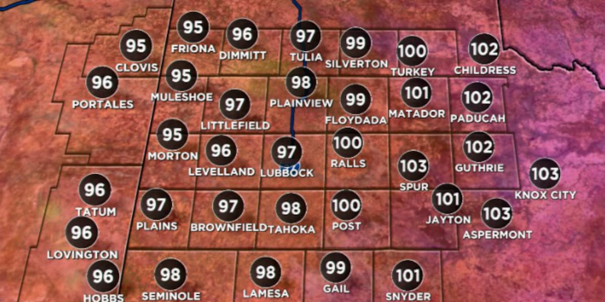
Lubbock is baking again this week.
While mostly dry, a few isolated pop-up storms might briefly cool things down Monday evening, but don't expect widespread relief. The dominant factor remains the high pressure system settled just to our east.
This extended scorcher means higher electricity bills for folks cranking the AC from Raintree to the North Overton area. It poses real risks for anyone working outside, especially those on construction sites near 19th Street or tending fields off the loop. Stay hydrated and keep an eye on pets and elderly neighbors. Even a quick trip to the South Plains Mall will feel like a trek across a frying pan, making afternoon errands a sweaty challenge.
This heat wave follows a surprisingly mild spring, reminding us quickly what West Texas summers truly deliver.
Common questions
What temperatures can Lubbock residents expect this week?
- Lubbock city limits, including areas like the Depot District and Tech Terrace, will see temperatures climb well into the upper 90s for several days. Surrounding areas like Slaton and Post could reach 105 degrees by Tuesday, marking the season's hottest stretch.
How long is the high heat expected to last in the South Plains?
- The oppressive heat ridge is expected to stick around through midweek, keeping the entire South Plains region under its thumb. A stubborn high-pressure system parked directly over the area is the primary cause for this extended scorcher.
Will there be any relief from the heat in Lubbock?
- While mostly dry, a few isolated pop-up storms might briefly cool things down Monday evening, but widespread relief is not expected. The dominant factor remains the high-pressure system settled just to our east, maintaining the intense heat.
Stay in the loop
Weekly Lubbock news, deals, and events. Free.