
Local News
South Plains Heavy Rain Threat - KCBD
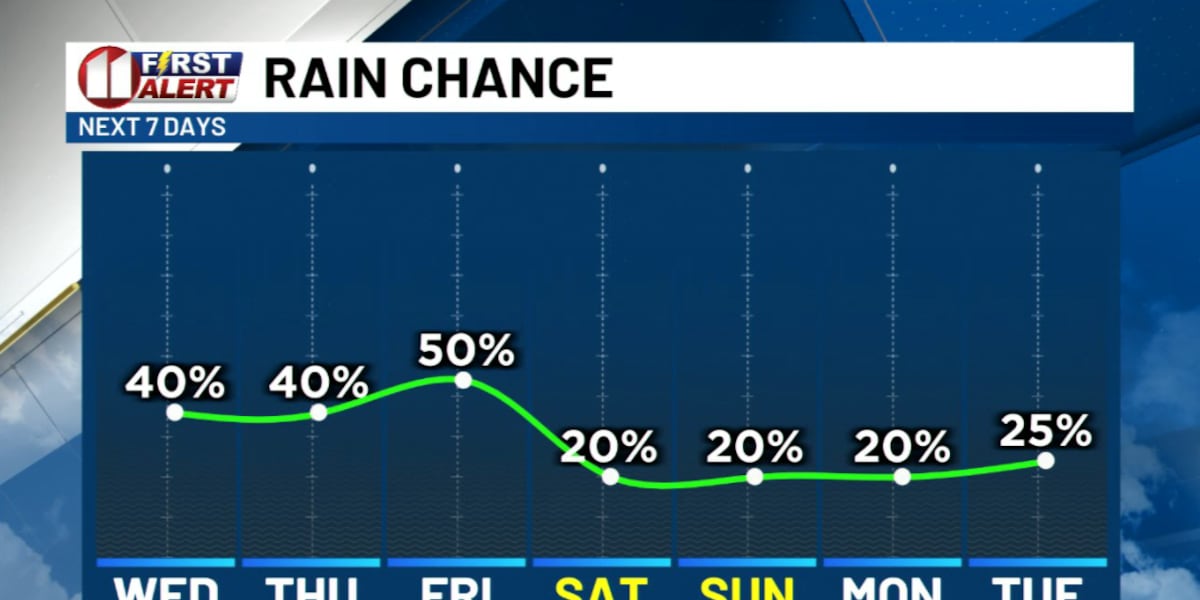
Widely scattered thunderstorms are expected to move across the South Plains this evening and overnight, with some spots picking up as much as 3 inches of rain and a real risk of flash flooding.
The atmosphere is carrying a lot of moisture right now, which means any storm that fires up has the potential to dump heavy rain fast. That said, this kind of pattern is patchy by nature. Some neighborhoods could get soaked while others stay bone dry, and that unevenness is expected to continue with rain chances sticking around each day through the work week.
The main worry isn't the rain totals across the region as a whole, it's what happens when several inches fall in a short window over one spot. Flash Flood Warnings and Flood Warnings are likely to pop up for specific areas as storms roll through, so it's worth paying attention to alerts rather than just checking the forecast once and moving on. Low-lying roads and underpasses tend to fill quickly in these setups, and that's usually where trouble starts for drivers.
For anyone with outdoor plans this week, the message is simple: don't assume a dry morning means a dry evening. The same storm system that skips your street could stall out three miles away and turn a quiet Tuesday into a flooded one.
Stay in the loop
Weekly Lubbock news, deals, and events. Free.