
Weather
Severe Storms and Flash Flood Potential Return
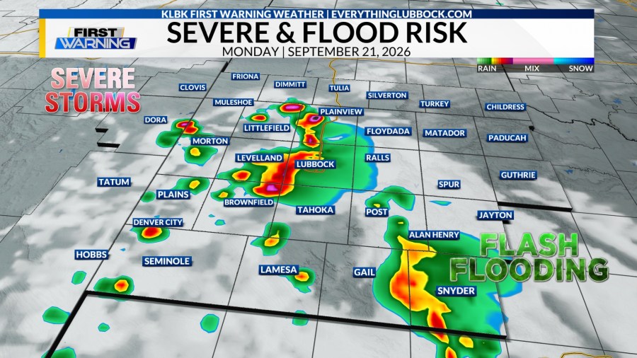
Severe thunderstorms with flash flood potential will move across Lubbock Monday afternoon, bringing a high near 87 degrees and southeast winds of 10 to 15 mph, according to KLBK Chief Meteorologist Jacob Riley.
Scattered showers and storms build after lunchtime and spread across the region through the evening. The storms carry into the night, with skies staying mostly cloudy and the low dropping to 63. Winds shift out of the ENE at 8 to 12 mph overnight as the system lingers over the South Plains.
Anyone driving 19th Street or the Marsha Sharp Freeway during the afternoon commute should watch for standing water, especially in low-lying spots that flood fast when storms stack up back to back. The city's flat terrain and clay soil drain slowly. Even a short burst of heavy rain can turn an underpass into a problem within minutes. Outdoor plans around the Depot District or anywhere near Texas Tech might need a backup for the evening if the storms hold their timing.
Riley's forecast points to an active pattern rather than a single quick-moving system, so the threat doesn't clear out with sunset. Folks in Lubbock heading out after dark should keep an eye on radar before they leave the house.
Stay in the loop
Weekly Lubbock news, deals, and events. Free.