
North winds of 20 to 30 mph will keep blowing through most of Friday, easing late in the afternoon or early evening. Clouds and that breeze hold lows in the 40s early Friday morning.
Friday will be the chilliest day the area has seen in quite some time, with highs only reaching the mid to upper 50s. The last time Lubbock measured a daytime high below 60 degrees was March 16.
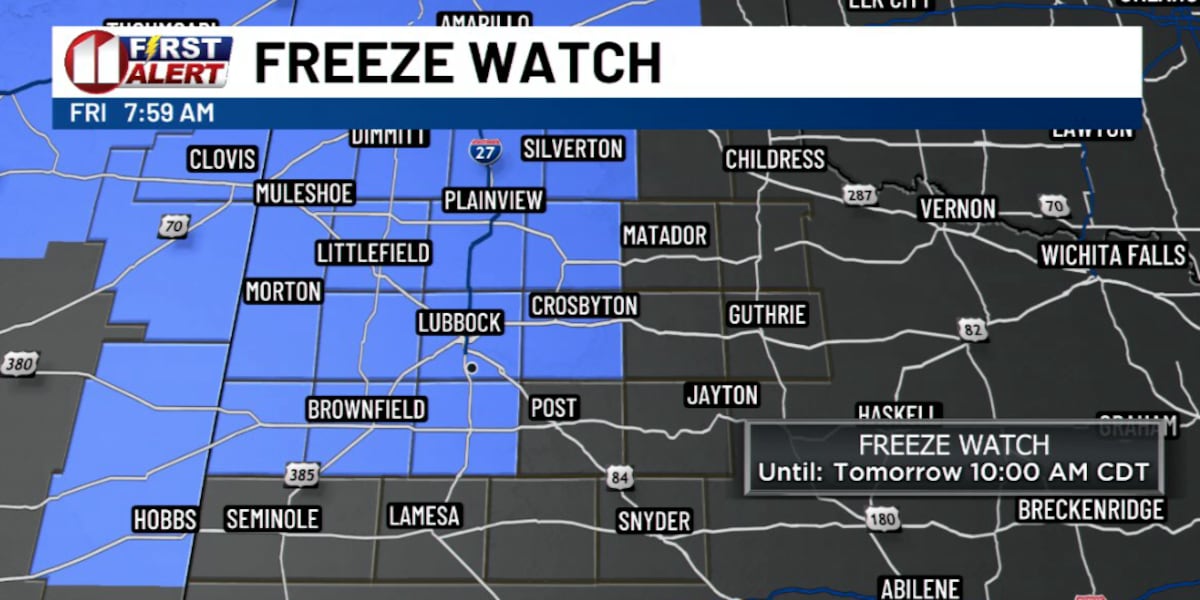
The real drop comes after dark. Winds fall off quickly Friday evening as surface high pressure settles over the region, and high clouds clear out. Overnight, light winds and clear skies set up good radiational cooling. Areas to the northwest have the highest chance of hitting freezing, but much of the Caprock is likely to get there.
Anyone heading out early Saturday should expect temperatures well below the 40s Friday morning brought.
With normal temperatures returning next week, this cold snap barely gets a weekend.