
At 6:02 p.m., a severe thunderstorm capable of producing a tornado sat 7 miles north of White River Lake, moving east at 30 mph. It was headed for Dickens, with arrival expected around 6:20 p.m.
More storms are coming. Scattered thunderstorms, some possibly severe, are likely in and near the South Plains tonight. Atmospheric moisture is running at levels more common in summer than mid-October. The area most likely to see severe storms sits generally east of the Interstate 27 and Highway 87 corridor.
Strong wind gusts are the main severe threat across most of the area. Eastern areas, especially off the Caprock, also face large hail. A brief, isolated tornado is a low risk, mainly over the northern Rolling Plains and the southeastern Texas Panhandle.
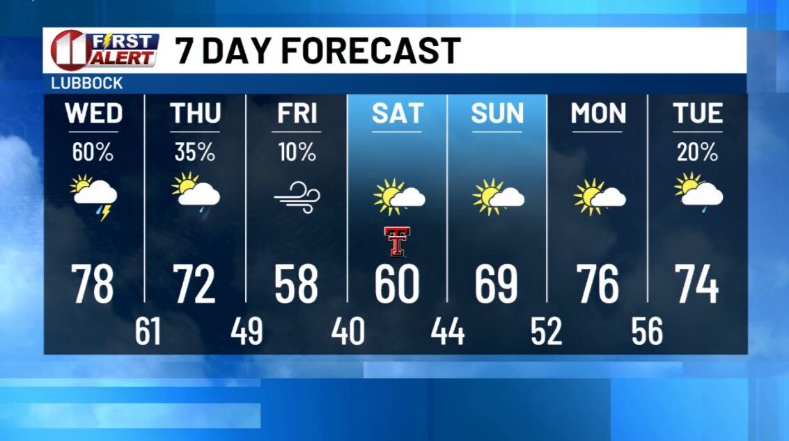
Because these storms produce rain efficiently, flooding becomes more likely if more than one passes over the same spot. A flash flood watch runs through Wednesday for the northeastern KCBD/FOX34 viewing area. For the southern part, where two or more inches could fall, it runs through Thursday night. Another round of showers and a few thunderstorms is expected before sunrise Wednesday.
The soaked, summer-like air gives way to a rather dramatic cooldown heading into the weekend.